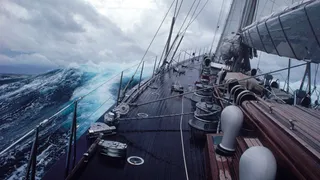
The Bayesian tragedy raises the question: do extreme weather events pose an increasing threat to superyachts?
It was a calm night at anchor, but thunderstorms were forecast and occasional flashes of light could be seen in the distance. The captain retired to his cabin, leaving instructions for the watch crew to wake him if the winds increased to more than 20 knots or if there was any sign of dragging anchor.
At 3am the deckhand on watch noted that thunderclouds and lightning appeared to be getting closer, yet the wind remained at eight knots. At 3:55am he closed the hatches as it started to rain. From that point, the weather rapidly deteriorated; the wind picked up to 30 knots and the yacht started to drag anchor. At 4:00am the deckhand woke the captain. The chief engineer woke at the same time and began to make preparations to maneuver. Any crew members who didn’t get up with the change in motion were woken to help.
As the captain prepared to maneuver the yacht, the wind suddenly increased to more than 70 knots. At 4:06am, the 183-foot sloop violently heeled 90 degrees to starboard, taking less than 15 seconds to do so, as crew, guests and furniture fell across rooms and decks. The generators shut down and water spilled over the starboard side rail; within seconds it was cascading down stairwells.
This is the real-life worst-case scenario of Bayesian, the foundering on August 19, 2024 near Porticello, Italy, that cost six guests and the chef their lives. In May, the UK Marine Accident Investigation Branch (MAIB) released an interim report with these details. In addition to commissioning a stability study — which concluded that with the centerboard raised, the yacht could not return to an even keel after heeling more than 70.6 degrees — the MAIB had the UK’s national meteorological service, the Met Office, analyze that night’s weather conditions.
Its study of satellite imagery indicated that a “mesocyclonic storm front was demonstrating the properties of a significant supercell with associated downdrafts and possible near-surface winds in excess of 100mph.” It concluded that a mesocyclonic storm was highly likely, a supercell was probable, and tornadoes and downdrafts were possible. In other words, the wind that pushed over the yacht could have come from a hurricane-force downdraft or a tornado associated with a severe thunderstorm.
Supercells are the least common and most dangerous type of thunderstorm. They typically occur over the central US and are fairly unusual in the Mediterranean. They spawn most large, violent tornadoes and have two downdraft regions. While all thunderstorms have downdrafts, they normally aren’t powerful enough to knock down a large yacht. A microburst, on the other hand, is an intense downdraft where wind speeds can exceed 100mph at the location it first strikes.
Maritime attorney Michael Moore describes it like a bomb landing on the water. He had a case more than 20 years ago when a microburst caused a cruise ship to lose control in the port in Miami.
“It was a ‘what the hell’ moment,” he says. “The ship was outbound in the Miami ship channel and had just cleared the cruise ship terminal. After the burst, the bow started swinging to port on a collision course with a fuel barge docked on the north side of the channel.” The captain’s quick thinking in ordering all anchors dropped managed to save the ship.
If a microburst were to blame for Bayesian’s sinking, meteorologist Steven Lazarus of the Florida Institute of Technology explains that it would not have been predictable. “The conditions favorable for microburst activity are well known and can cover a relatively broad region of hundreds of kilometers. However, the chance of any one particular location experiencing it can still be quite low,” he says.
If it was a tornado that took down Bayesian, the MAIB report points out that it could have only affected an area of 50 to 100 meters across, which would explain why a neighboring vessel that dragged anchor in the same direction did not sink. The MAIB calls it a tornadic waterspout, which Dr Lazarus says is a misnomer. “If the storm had a mesocyclone, then it is a tornado over the water, not a spout. Waterspouts are different in how they form; they are smaller and less violent,” he says.
The big question is whether captains can expect more frequent and more intense weather events in coming years, as numerous studies have linked an increase in extreme weather with global warming scenarios. One specifically, “Effect of a Positive Sea Surface Temperature Anomaly on a Mediterranean Tornadic Supercell,” concluded that warm sea temperatures “may favor supercell formation and intensification over the Mediterranean.” The sea temperature that night around Sicily was a record high of about 30°C.
The Bayesian investigation is ongoing. It will be interesting to see what guidance the MAIB will offer on actions to be taken in extreme weather in its final report. As Captain Jonathan Kline says: “Coming up with a RASOP for a severe weather anomaly, rapid catastrophic flooding and abandon ship while at anchor — that will be a first.”

